Route details
Description
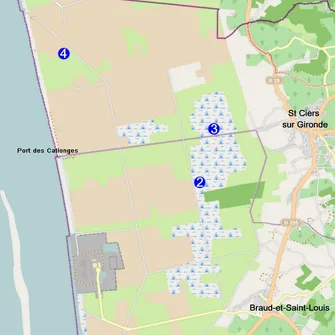
Linked offers
Your itinerary
Step 1
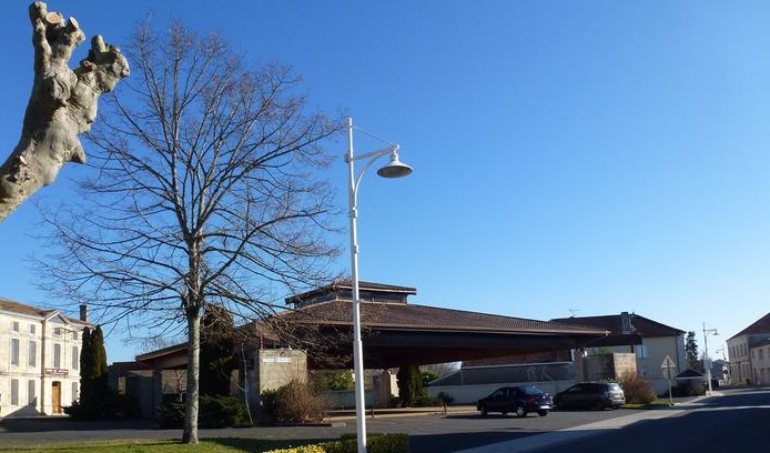
The start of this route is located on the market square, located in the heart of the village of Braud and Saint Louis. This commune takes its name from the meeting of 2 parishes at the beginning of the 19th century, Braud, meaning "marshy lands" in Old French, and Saint Louis, a parish founded in the 17th century on the edge of an estuary which has completely disappeared today. Take the time to observe the three main monuments of the village: the Saint Saturnin church, the covered market hall and the Sailors' Cross.
Step 2
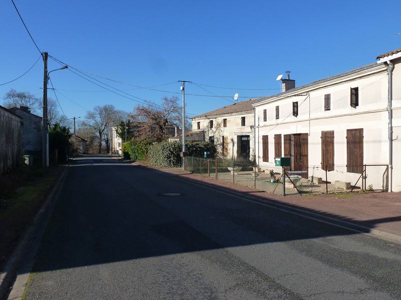
Turn your back on the church and go to the right following the D136E3. At the roundabout, turn left to take Route du Port. You cross the places called Pied Sec and Le Buchaud, then arrive at the place called Le Port. Crossing this place, you can observe houses on both sides of the road, including some beautiful old residences, some restored and others abandoned.
Step 3
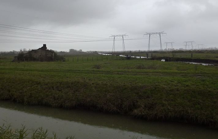
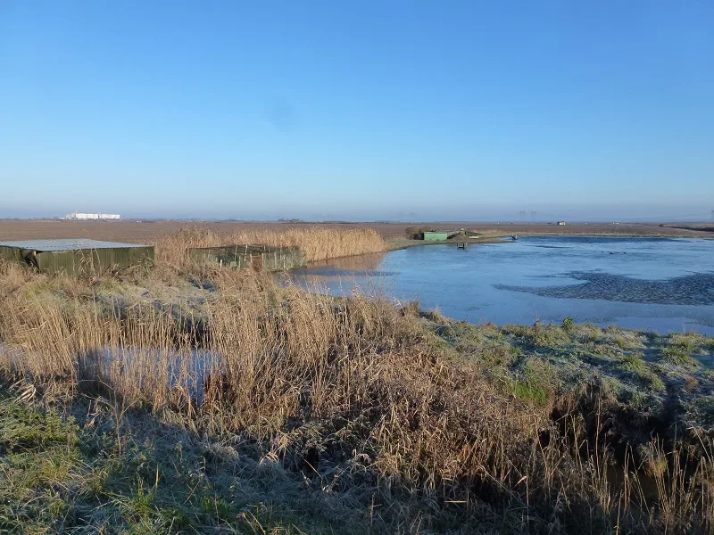
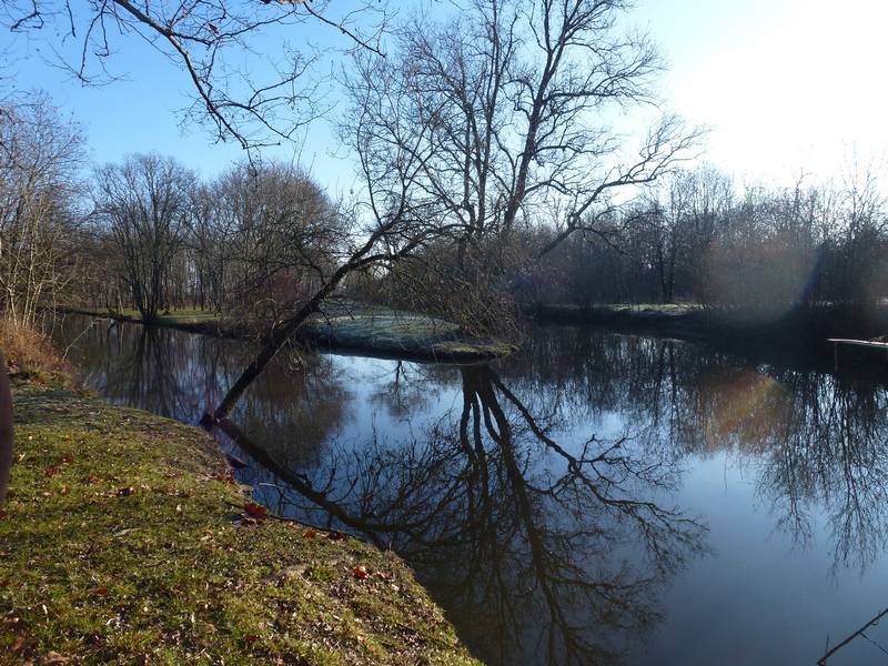
At the crossroads, after leaving Le Port, cross the canal, take the first road on the left just after the bridge and go forward until the give way. From there, you leave the inhabited area, the landscape opens up: you will immerse yourself in the Marais de Saint Louis Saint Simon which extends as far as the eye can see. In the background of this marsh landscape, the Blayais Nuclear Electricity Production Center stands out, from which very high voltage lines stretch in places. Commissioned in 1981, the installation of this site required some specific developments like this road that you are about to cross. Called “heavy track”, the D136 or Saint Louis road has been reinforced to support the passage of exceptional convoys coming from or leaving for the power station. At certain times, this road is very busy. So be extra careful when crossing, and take the asphalt road that leads opposite.
Just after the very high voltage line, you will see on your left a ruined building, witness to the evolution of housing and agricultural practices. The small shelters were used for livestock, while the larger buildings were inhabited; on the ground, no foundations, which the marsh would have destabilized, but clay or a simple terracotta paving. The comfort of homes in the marsh then evolved thanks to the arrival of electricity in 1952.
Next to this ruin, a stone bridge remains, which allowed people to cross the canals in order to move between the different plots of the marsh. To differentiate them, it was customary for the first woman to cross a bridge to give it her first name.
Step 4
Continue on the asphalt road along the canal, between cultivated land and developed water bodies. Then, after a right turn and, a little further on, a left turn, come to a crossroads. On your left, opposite the intersection, a high cage is placed not far from a cabin camouflaged in the vegetation. Depending on the season, this cage can contain a live duck allowing you to practice “ton hunt”, waterfowl or “waterfowl” hunting, practiced at night, from the first Saturday in August to the end of January. The numerous bodies of water present on both sides of the road, and the associated “tons”, more or less buried huts, allow this traditional practice in these marshes.
Step 5
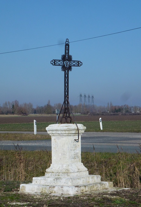
At this crossroads, you have the possibility of going back and forth to the Saint Louis cross, a gap which takes you a little less than 2 additional kilometers. In this case, follow the road which goes on your right towards the Port des Couvertures. Once you arrive at the cross, turn around to return to the signs at the intersection and return to the Braud and Saint Louis loop.
Step 6
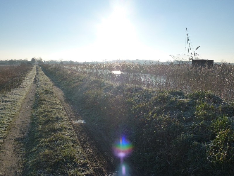
Continue straight ahead following the direction “Boucle de Braud et Saint Louis” indicated on the sign on your left. At the end of the path, behind the dike, the Canal Saint Georges known as “Canal des Sables” flows; you can climb the sea wall to get a better view of the canal.
Step 7
Continue your path and, quickly, you will find on your left, an old farmhouse recently restored, La Gadelle. Further on, once you have crossed the barrier, you walk on a dike separating the canal on your right and the marsh land, up to a place called Le Passage. The D 255 or “Route des Marais”, linking Braud-et-Saint-Louis to Blaye, is very busy, be careful. Before crossing it, you can enjoy a very beautiful view of the Saint Georges canal from the road bridge, and take a look at the destroyer boat often parked below. This boat has some sort of metal “ears” at the front, which, when deployed, allow the banks of the canal to be devastated. Thus, when the tide is low in the estuary, and therefore the canal is dry, the water retained upstream, in the Vergne marsh, is released in order to guide the destroyer boat which then drifts towards the estuary. by “scraping the muddy deposits from both sides. This delicate operation is repeated every 15 days in summer. After crossing the road very carefully, you will be able to take a closer look at the 3 Passage locks and the old lock keeper's house nearby, which today houses the staff in charge of managing the Livenne watershed.
Step 8
Now take the small grassy path which runs along the Saint Georges canal on the left, along the edge of which there are a few squares in places. On the other side of the canal, the old destroyer boat ends its life on the grass.
Step 9
At the end of this path you arrive at the “Patte d’Oie”, the junction point of three canals, from north to south: the Saint Simon canal, the Saint Georges canal and the Demiers canal. Go around the square in front of you and continue the path along the Saint Simon canal. On your left, La levee de Marquet is the dike which separates the brackish water of the Saint Louis Saint Simon marsh to the north, part of the marsh called the “Montalipan”, from the fresh water of the Vergne marsh to the south, which is revealed on your right. Lined with plane trees, this portion of the trail is nicknamed the “Alley of Sighs”. These old plane trees are threatened by an insect called the plane tree tiger (Corythucha ciliata). Originally from America, this bug feeds on the sap of leaves which end up falling prematurely, impacting the life cycle of trees and strongly threatening these plantations. You can occasionally take the levee to enjoy the view of the Marais de Saint Louis Saint Simon, or to bypass a flooded area of the trail, depending on the season.
Step 10
At the end of this path, you arrive at the limit of the low marsh marked by the marquet bridge. The landscape changes, you find an asphalt road and go up towards the place called Marquet. You pass on the right an important building which belongs to Château Marquet de la Paillerie, and come to an intersection. Cross the road and go up to the left on the sidewalk. At the first intersection, take the road which goes to the right and goes around a farm on the corner. At the next intersection, turn left to join the main road, following vines and asparagus fields. The vineyards of Braud and Saint Louis extend mainly to the upper part of the commune, that is to say above water. It is in the Blaye Côtes de Bordeaux appellation.
Step 11
Once the main road is reached, you go back towards the city center on the right via rue Kléber Marsaud, name of a former mayor of Braud and Saint Louis. At the intersection, continue straight to reach the Market Square.